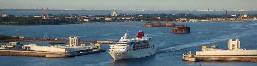


The way to Kronstadt lies on the St. Petersburg floods protection facility complex ("the Dam"). This is a unique 25 km. hydrotechnical construction with the 6 lane highway on its top. The Dam consists of 11 dams, 2 water-locks, 1.8 km long underwater tunnel and 2 km long bridge.
The complex is intended to protect Saint-Petersburg from storm surges by separating the Neva Bay from the western part of the Gulf of Finland. Historically, the storm winds from the gulf had caused over 300 floods in the city, several of which had a massive devastating effect. The dam has the capability to protect the city from water rising up to 6 meters.
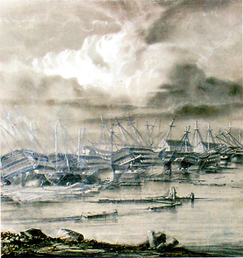
First projects of the Dam were submitted for consideration after the flood of 1824. During this flood water level in the Neva River rose more than 4 meters. Kronstadt and St. Petersburg have been washed away the storm. However, the idea was considered unrealizable and the city annually suffered from floods. For years, prominent scientists and statesmen of imperial Russia developed various plans for flood protection, and the Soviet Union implemented the idea.
The flood of 1955 finally made it clear that the city needed a protection dam. Many options were considered before the Soviet government decided on a 25.4 km (15.8 mi) complex of 11 dams, including a six-lane highway on the top.
The project was begun in 1979, and construction continued through 1995, at which point the dam was around 70% complete. In fact construction was completed only in 2011, and the formal opening of the complex was on 12 August 2011.
The consequences of the flood in 1824 ----->>>
The Complex consist of 11 dams and 2 water-locks ( the northern and the southern) which used for shipping.
The most interesting facilities are 2 water-locks.
The purpose of the northern one:
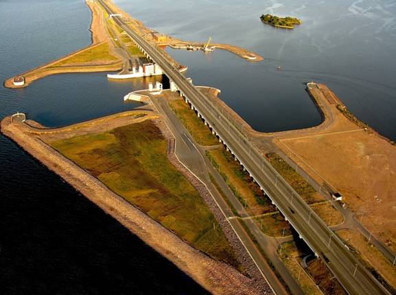
1. The passage of vessels of "river-sea" class with a draft of up to 5.3 meters;
2. To protect the city from flooding;
3. The road transport communication by bridge over the navigable canal.
Technical features:
The width of navigation pass holes - 110 m;
The depth at the threshold - 7 meters;
The length of the ship channel (with protective fencing moles) - 350 m
The construction equipped with a flat lift water-gate.
The road bridge has length 1500 meters and vertical clearance 16.4 meters.
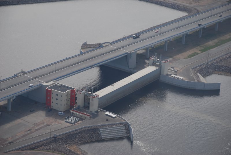
The southern water-lock is the heart of the Dam. The main elements of the navigation structure of the water-lock are: floating gate consisting of two caissons, road tunnel constructed under the navigation channel (the channel width is 200 m, depth 16 m), and engineering structures (to maintain the tunnel and gate).
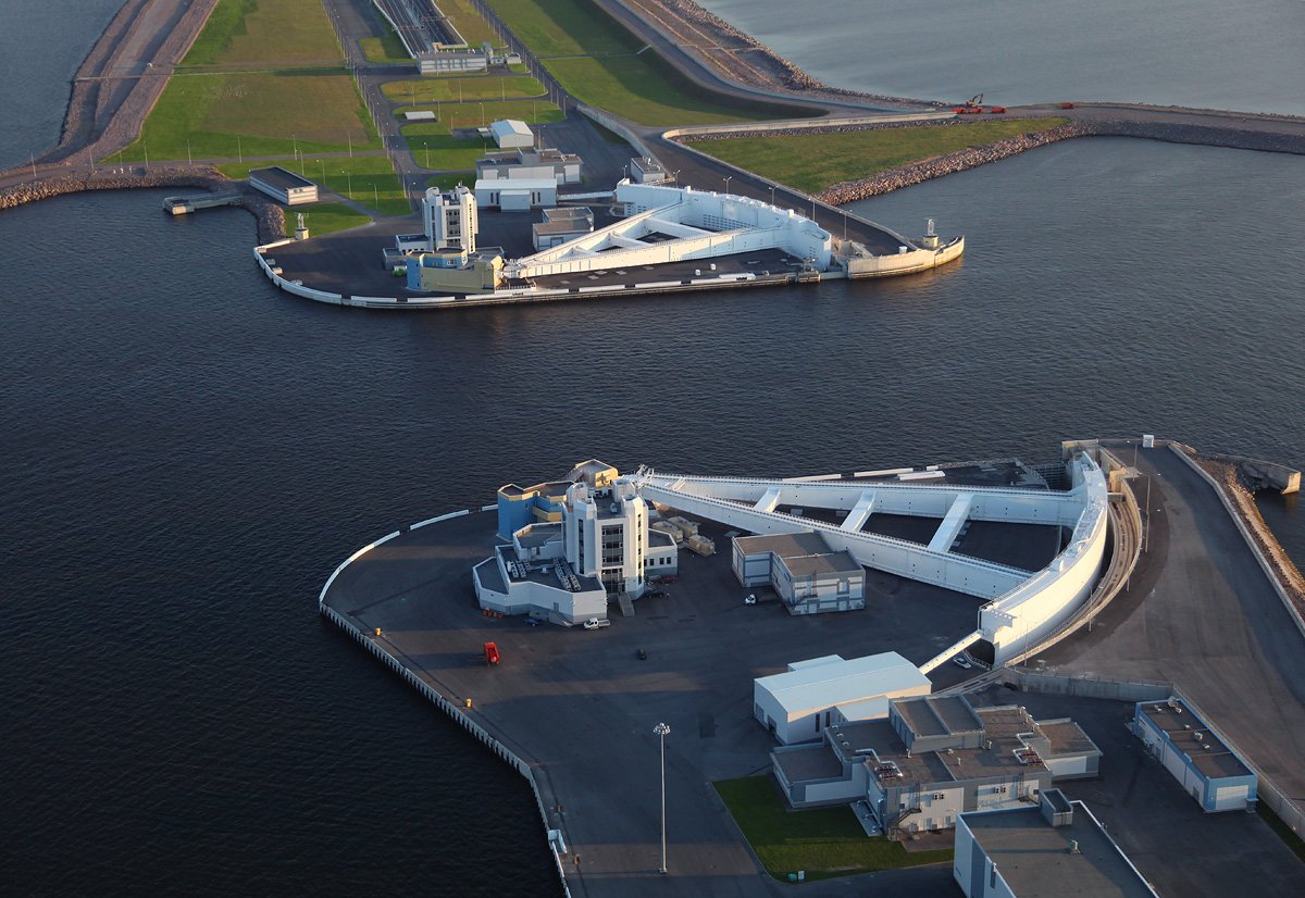
The most important elements of the navigation structure are the floating radial steel gates. Each radial gate (caisson) is connected to the cast steel hinge joint with a ball via two 120 m long horizontal steel arms. The arm has a shape of a turned upside down letter "A" with the top connected to the ball. The diameter of the ball is 1.5 m. The ball in the hinge joint is the point of rotation in the construction.

Road Tunnel was created under the southern water-lock. This is a 1,961 m long tunnel which consist of two transport corridors, each 15.25 m wide and 5.5 m high. The deepest section of the road in the tunnel is 24.3 meters (under the marine channel).
photos by N. Ivanov